Steady climb
Ascencio valley
Hotel to Refugio Chileno
Book the day hikeWhere is your stop
Base of the Towers day hike from Puerto Natales
★ 4.8 · 878 written reviews
Answer in brief
The Base Torres trail climbs from Hotel Las Torres up the Ascencio valley to Refugio Chileno, through lenga forest to the Torres ranger post and over the moraine to the lagoon, then returns the same way.
On the map
Check out 16 stops
Select a route, then tap a marker or stop to see its note and open Google Maps.
The hikers' base at the entrance to Las Torres reserve, with free bathrooms and drinking water; the trail starts in the Hotel sector beside it.
Google MapsThe hotel at the foot of the Ascencio valley; CONAF measures the first section, 5 km and 2 hours to Chileno, from here.
Google MapsThe bridge over the Ascencio river near the start, where the climb up the valley begins on private Estancia Cerro Paine land.
Google MapsThe narrow, windy pass above the Ascencio gorge, where the trail turns west and drops toward the refuge.
Google MapsThe refuge and campsite halfway up, open from 1 October 2026 to 25 April 2027; refill your water here.
Google MapsThe ranger post at the top of the forest, 3 km and 90 minutes above Chileno, where the moraine climb begins.
Google MapsThe end of the trail, 1.4 km and 1 hour above the ranger post, at about 850 meters above sea level.
Google MapsThe turquoise glacial lagoon at the foot of the towers; the park prohibits swimming in all its lakes and lagoons.
Google Maps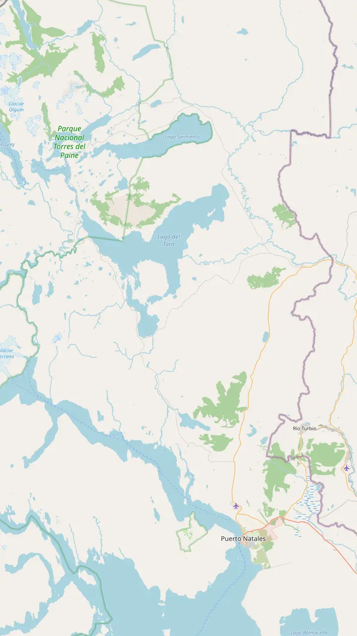
The harbor town where the guided day hike collects you between 6:15 and 6:45; park buses leave its terminal each morning and early afternoon, with times that differ between CONAF and Bus-Sur.
Google MapsThe park's eastern gate; Route 9 North via Cerro Castillo reaches the Sarmiento and Laguna Amarga gates in 115 to 145 km.
Google MapsThe park's main gate, where tickets are checked and the Las Torres shuttle leaves for the Welcome Center, 7 km and 25 minutes away.
Google MapsThe hikers' base at the entrance to Las Torres reserve, with free bathrooms and drinking water; the trail starts in the Hotel sector beside it.
Google Maps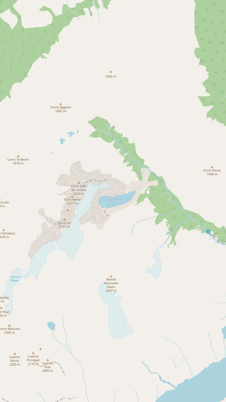
The ranger post at the top of the forest, 3 km and 90 minutes above Chileno, where the moraine climb begins.
Google MapsThe end of the trail, 1.4 km and 1 hour above the ranger post, at about 850 meters above sea level.
Google MapsThe turquoise glacial lagoon at the foot of the towers; the park prohibits swimming in all its lakes and lagoons.
Google MapsThe southern tower, on the left as you face the group from the lookout.
Google MapsThe middle tower of the granite group, shaped by glacial ice.
Google MapsThe northern tower, on the right as you face the group from the lookout.
Google MapsThe peak north of the towers that closes the cirque on the right side.
Google Maps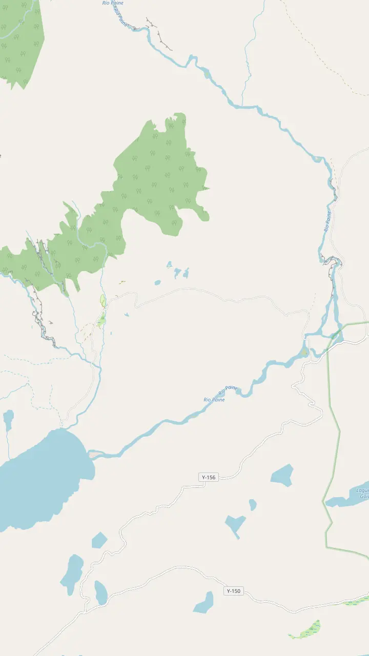
The park's main gate, where tickets are checked and the Las Torres shuttle leaves for the Welcome Center, 7 km and 25 minutes away.
Google MapsThe hikers' base at the entrance to Las Torres reserve, with free bathrooms and drinking water; the trail starts in the Hotel sector beside it.
Google MapsThe hotel at the foot of the Ascencio valley; CONAF measures the first section, 5 km and 2 hours to Chileno, from here.
Google MapsThe bridge over the Ascencio river near the start, where the climb up the valley begins on private Estancia Cerro Paine land.
Google MapsThe campsite area near the hotel, open from 15 September 2026, a short walk from the trail start.
Google Maps© OpenStreetMap contributors, map data
Use this Base Torres hike map to see the trail before you walk it: each section with its distance and time from CONAF, where to refill water, where the wind hits and where the climb gets hard.
Editorial team, baseofthetowershike.com · Updated November 12, 2026 · Takes 8 min
Essentials
The Base Torres hike map is simpler than the mountains around it suggest. There is a single trail, and you walk it up and back. Las Torres Patagonia counts 22 kilometers there and back from Hotel Las Torres, with an average of 4 hours each way.1 Chile's tourism board gives the same 22 kilometers and allows between 8 and 10 hours for the whole day.6 The gap between those figures is your stops, your pace and the queue of hikers on the moraine.
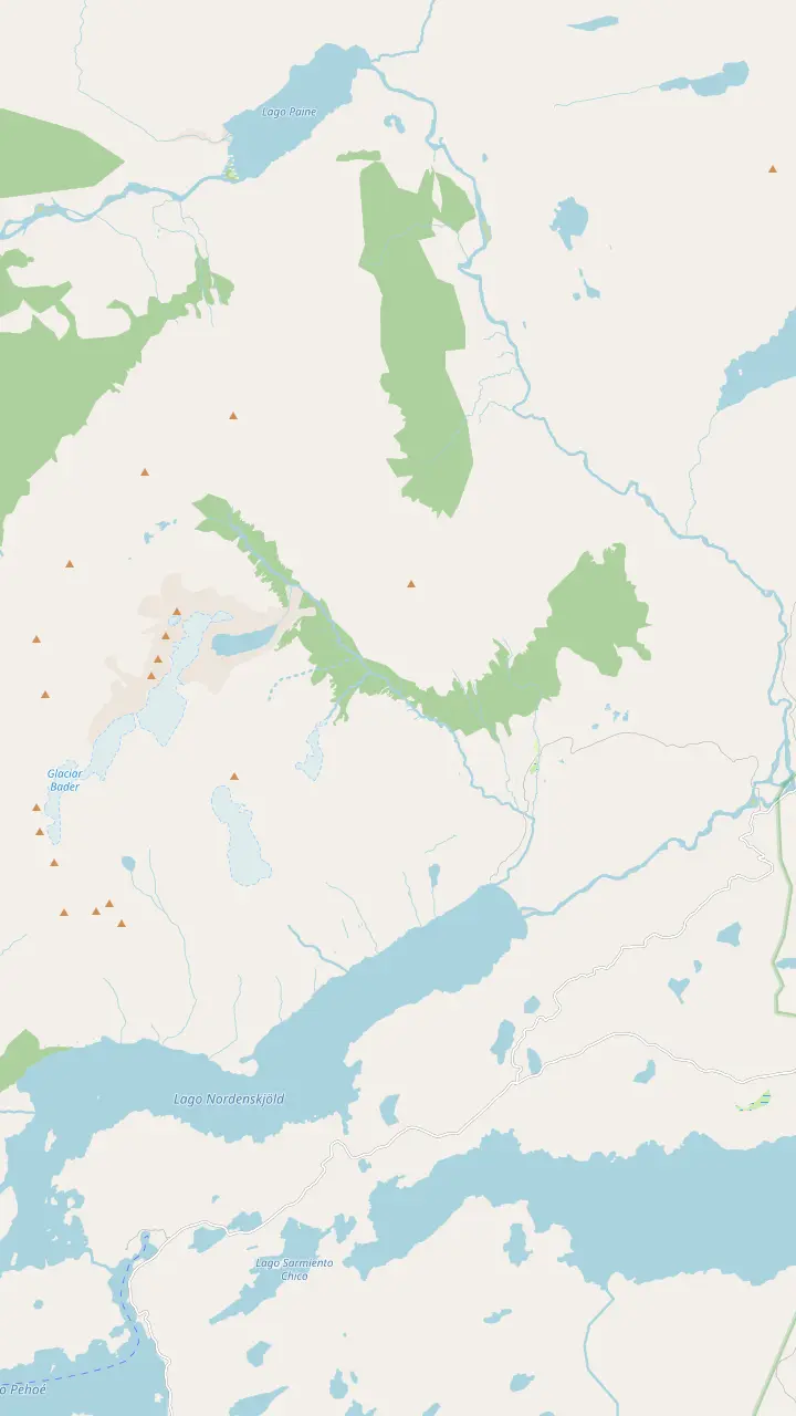
CONAF's trail table divides the walk into stages, and those stages are the clearest key to the map. The hotel to the refuge measures 5 km and 2 hours, the refuge to the ranger post 3 km and 90 minutes, and the ranger post to the lookout 1.4 km and 1 hour.2,3,4 The map on this page marks each of those points, from the Welcome Center at the bottom to the lagoon at the top. Read the pins in order and this Torres del Paine base hike map gives you the whole day at a glance.
Those official times are averages for a steady walker without long breaks. Add time for photos, food and the crowds on the narrow upper path in high season, and remember that the way down is not much quicker on the moraine. The map panels let you switch between the full route, the trailhead area, the road from Puerto Natales and a close view of the lookout and the towers. Zoom in on the route panel to see how the trail bends west at the pass.
CONAF's trail table
| Section | Distance | Time | Summer | Winter |
|---|---|---|---|---|
| Hotel Las Torres to Chileno | 5 km2 | 2 hours2 | Medium | Difficult |
| Chileno to the ranger post | 3 km3 | 90 minutes3 | Medium | Difficult |
| Ranger post to the lookout | 1.4 km4 | 1 hour4 | Demanding | Difficult |
Distances and times each way, with difficulty ratings from CONAF's page for Torres del Paine National Park.2,3,4
The walk begins near the Welcome Center and Hotel Las Torres, where Chile's tourism board places the official start of the trail.7 The first stretch crosses open ground to the Ascencio river and then climbs the eastern side of its valley. CONAF notes that this section runs through the private land of Estancia Cerro Paine, owned by the Kusanovic family.10 The track here is wide and easy to follow, and it is the warm-up for everything that follows.
Here the day's first sustained climb begins; find a rhythm you could keep up for hours. CONAF rates the hotel to Chileno section medium in summer and difficult in winter.2 The trail rises steadily on a broad slope, with the ice-capped mass of Mount Almirante Nieto across the valley and condors riding the wind above it, as Chile's tourism board notes.11 Look back now and then: the lakes on the plain below grow bluer as you gain height.
Near the top of the climb the trail swings west into the gorge at Paso del Viento. Las Torres describes the pass as a narrow trail that greets you with a strong Patagonian breeze.8 The wind funnels through this notch. Stow loose items before you reach it, keep your poles close and give oncoming hikers room on the narrow path. On a calm day you will barely notice the pass; on a wild day it is the hardest stretch before the moraine. Save your appetite for the refuge just below; the hardest climbing of the day is still ahead.
From the pass the trail drops into the valley floor and reaches Refugio Chileno, the refuge and campsite run by Las Torres. Its doors are open from 1 October 2026 until 25 April 2027, per the park bulletin.9 It is the natural place for a first long break, a snack and a look at the sky ahead before you commit to the upper valley. If the weather is turning, this is the last comfortable place to change the plan.
Water is the main reason to stop. Las Torres points hikers to the hotel lobby and then the refuge for refills, and says every lodging in the park and the reserve has drinking water.5,17 Outside the refuge season, plan to carry what you need from the start, as the refuge will not be open to refill. Carry enough for the climb ahead, judged by your own thirst on a warm day rather than by a rule of thumb.
Toilets on the mountain are basic. In the high country, CONAF says, toilets are rudimentary and waste goes untreated; use the facilities at the start and at the refuge instead.18 The park also makes registration at ranger stations mandatory on arrival, and the Torres ranger post higher up is one of them.19 Registering takes a minute and tells the rangers who is on the mountain that day.
How far today?
Fitness, weather and time set your turnaround.
If I want to see if the full route suits me
Walk to Chileno first
Hotel to Chileno is 5 km and 2 hours; judge the weather and your legs there.2
If The wind is strong at the pass
Ask before you continue
Rangers can close access in high wind without notice.14
If I am short on time
Watch the closing time
In October and November the 15:00 turnaround at the lookout comes sooner than you think.15
If My knees struggle on rocky descents
Bring poles, go slowly
CONAF warns of joint injuries on the glacial moraine.16
If I would rather not navigate
Go with a guide
A bilingual guide sets the pace, and the van collects you in Natales.
Stage by stage
Steady climb
Hotel to Refugio Chileno
Book the day hike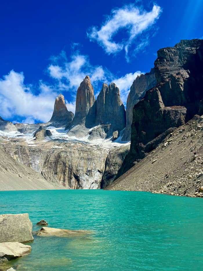
Sheltered
Chileno to the ranger post
Book the day hike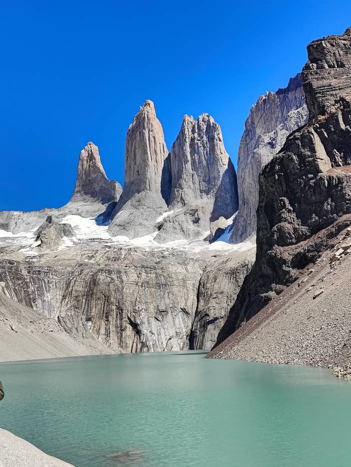
Steep and rocky
Ranger post to the lookout
Book the day hikeAbove Chileno the trail follows the river into the forest. CONAF describes the park's deciduous forest as dominated by lenga, the southern beech whose crooked trunks and small leaves line this section.33 The path climbs gently in places and crosses small streams, a welcome change of rhythm after the open slopes below. The ground is softer underfoot here, and the sound of the river follows you up the valley.
On CONAF's table this stage runs 3 km and takes 90 minutes, graded medium in summer and difficult in winter.3 The same table marks it as part of the W, open in winter only to guided groups under the park's cold-season protocol.12 In summer the trees break the wind better than anywhere else on the route, which makes the forest a good place to drink and eat before the moraine.
If you top up water on the way, Las Torres advises collecting it from secondary streams rather than the main river, which runs past trails, campsites and ranger stations.34 Faster-flowing water is the better choice. The ranger post at the top of the forest marks the end of the shade, and above it the official map gives an 18:00 summer closing time, while this season's bulletin closes the lookout at 16:00 even in midsummer.35,30 Treat the earlier time as a hard limit, not a suggestion.
Walk it with a guide
Pick a trek with a guide and say how many will walk.
Compare 3 side by side
Pick a trek with a guide and say how many will walk.
≈
View≈
View≈
ViewGetYourGuide's starting prices, converted at the ECB reference rate; exact pricing appears when you book.
Walking the route
Start
The official start, reached by shuttle from the Laguna Amarga gate.7
Valley climb
Hotel Las Torres to Chileno: 5 km and 2 hours, medium.2
The pass
A narrow, windy notch before the drop to the refuge.8
Halfway
Forest
3 km and 90 minutes through lenga forest.3
Finish
1.4 km and 1 hour up the moraine to the lagoon.4
The last section is short on the map and long in the legs. CONAF lists the ranger post to the lookout as 1.4 km and 1 hour, rated demanding in summer and difficult in winter.4 Chile's tourism board calls this stretch la morrena and describes it as the most challenging part, a steep climb between rocks.36 Expect to use your hands on the larger boulders, and to stop often to let your breathing settle.
CONAF adds a specific warning. The section crosses a glacial moraine, and hikers can suffer joint injuries to the legs there.16 Las Torres describes it as a rocky trail with a steep slope and no shade from the sun. Put on sunscreen before you start the climb and keep your hands free for the big steps.13 Poles help on the way down more than on the way up. Shorten them on steep steps so they take weight without throwing you off balance.
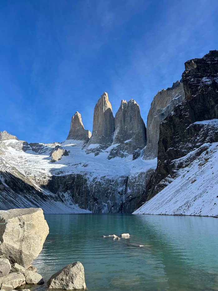
At the top the trail ends on the rocks above the lagoon, facing the towers. At the lookout you stand at the route's high point, which Las Torres puts at 850 meters above sea level.24 Sernatur's description of the prize is a turquoise lagoon beneath the massif, and the map panel for the towers shows how the water sits between the lookout and the granite.25
Video
One Cairn on YouTube · The video only starts loading on your tap.
Route checklist
There is no loop on the Base Torres hike route. You return the same way, down the moraine, through the forest, past Chileno and over the pass to the hotel. The descent on the moraine is where tired legs slip, so slow down there even if the rest of the walk felt easy. Below Chileno the trail is wider and the walking smoother again. Save some water and food for this part; the walk out is long, and the hotel is the next refill after Chileno.
Time the day around the cut-offs in CONAF's 2026-2027 bulletin.37 In high summer you can leave the gate as late as 10:00 and must start down from the lookout by 16:00; in October and November that turnaround moves to 15:00.30,15 The park says closing times exist to stop night from catching hikers before they reach their next stop.38 For a day hiker the next stop is the trailhead, and the closing time is set so that you reach it in daylight.
Plan for being out of contact. Mobile data and calls do not work on the park's inner trails, and CONAF's emergency channel is VHF 143.800 MHz.39,40 CONAF also cautions that in a mountain emergency, rescue may take hours to reach you, which is a good reason to turn around early rather than late.41 Tell someone at your lodging which day you are hiking, and when you expect to be back.
The route is well trodden and marked, and the rule is simple: stay on it. CONAF tells visitors not to leave the trails or take risks such as climbing rocks or running, and its record of fatal accidents in the park points mostly to lone walkers who strayed off the path.42,31 The park also advises against hiking alone at all.43 Walking with a partner, or with a guide, covers both rules at once.
Streams can change after rain or a warm spell. The park warns that rivers rise after heavy rain or thaw and tells hikers not to cross if the water is above the knees; ask the rangers if a crossing looks high.44 It is worth knowing the rule before you meet a swollen stream, rather than deciding on the bank. Rangers know the state of every crossing that morning, and asking costs nothing.
Leave the trail as you found it. Las Torres notes there are no bins on the way and that everything you carry in comes back out with you.45 The park can fine visitors up to CLP 200,000 for leaving rubbish, under Law 21.123.46 Use the free bathrooms at the Welcome Center before you start; the toilets at the park gates are the other reliable ones.23,47 Pack a small bag for your own rubbish and food scraps, and carry it out with everything else.
FAQ
Las Torres puts it at 22 kilometers from Hotel Las Torres, about 4 hours out and 4 hours back.1
The route goes up the Ascencio valley to the lookout and back down the same trail to the hotel.25
Neither phone nor internet reaches the park's interior trails, CONAF says.39
Las Torres describes it as a narrow trail with a strong Patagonian breeze on the way to Chileno.8
Sources
Related guides
Planning the Base Torres day? Ask a real person.