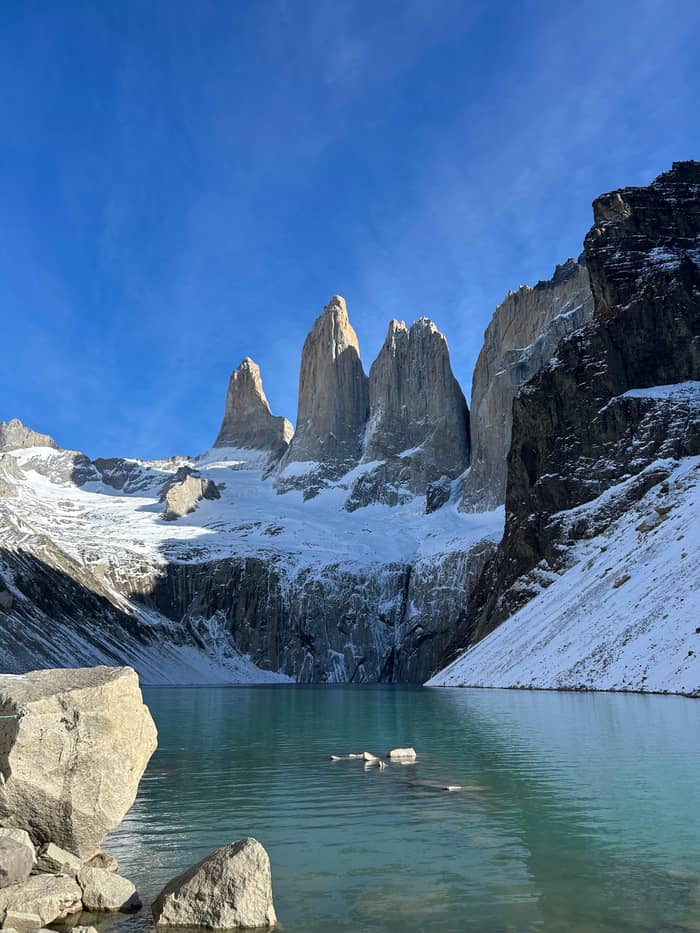
Left
Torre Sur
The southern tower
Book the day hikeWhere is your stop
Answer in brief
The Mirador Base Las Torres sits at about 850 meters above sea level, facing Torre Sur, Torre Central and Torre Norte across a turquoise glacial lagoon.
At the lookout
Check out 16 stops
Select a route, then tap a marker or stop to see its note and open Google Maps.
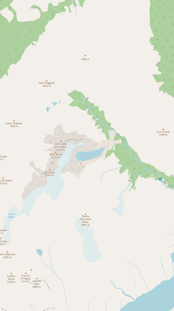
The ranger post at the top of the forest, 3 km and 90 minutes above Chileno, where the moraine climb begins.
Google MapsThe end of the trail, 1.4 km and 1 hour above the ranger post, at about 850 meters above sea level.
Google MapsThe turquoise glacial lagoon at the foot of the towers; the park prohibits swimming in all its lakes and lagoons.
Google MapsThe southern tower, on the left as you face the group from the lookout.
Google MapsThe middle tower of the granite group, shaped by glacial ice.
Google MapsThe northern tower, on the right as you face the group from the lookout.
Google MapsThe peak north of the towers that closes the cirque on the right side.
Google Maps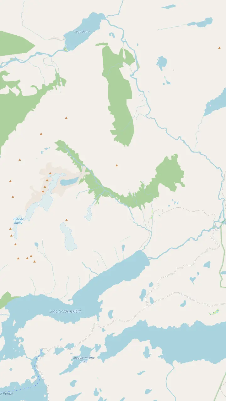
The hikers' base at the entrance to Las Torres reserve, with free bathrooms and drinking water; the trail starts in the Hotel sector beside it.
Google MapsThe hotel at the foot of the Ascencio valley; CONAF measures the first section, 5 km and 2 hours to Chileno, from here.
Google MapsThe bridge over the Ascencio river near the start, where the climb up the valley begins on private Estancia Cerro Paine land.
Google MapsThe narrow, windy pass above the Ascencio gorge, where the trail turns west and drops toward the refuge.
Google MapsThe refuge and campsite halfway up, open from 1 October 2026 to 25 April 2027; refill your water here.
Google MapsThe ranger post at the top of the forest, 3 km and 90 minutes above Chileno, where the moraine climb begins.
Google MapsThe end of the trail, 1.4 km and 1 hour above the ranger post, at about 850 meters above sea level.
Google MapsThe turquoise glacial lagoon at the foot of the towers; the park prohibits swimming in all its lakes and lagoons.
Google Maps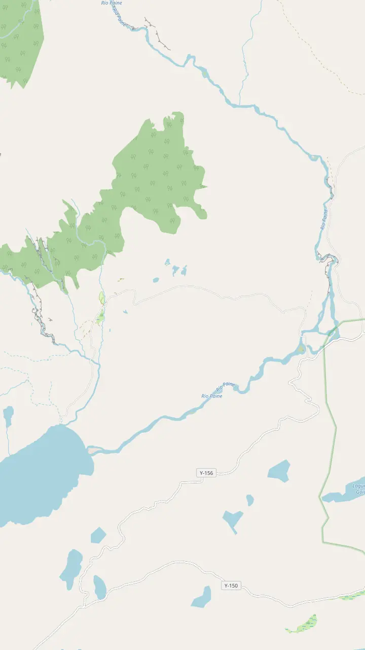
The park's main gate, where tickets are checked and the Las Torres shuttle leaves for the Welcome Center, 7 km and 25 minutes away.
Google MapsThe hikers' base at the entrance to Las Torres reserve, with free bathrooms and drinking water; the trail starts in the Hotel sector beside it.
Google MapsThe hotel at the foot of the Ascencio valley; CONAF measures the first section, 5 km and 2 hours to Chileno, from here.
Google MapsThe bridge over the Ascencio river near the start, where the climb up the valley begins on private Estancia Cerro Paine land.
Google MapsThe campsite area near the hotel, open from 15 September 2026, a short walk from the trail start.
Google Maps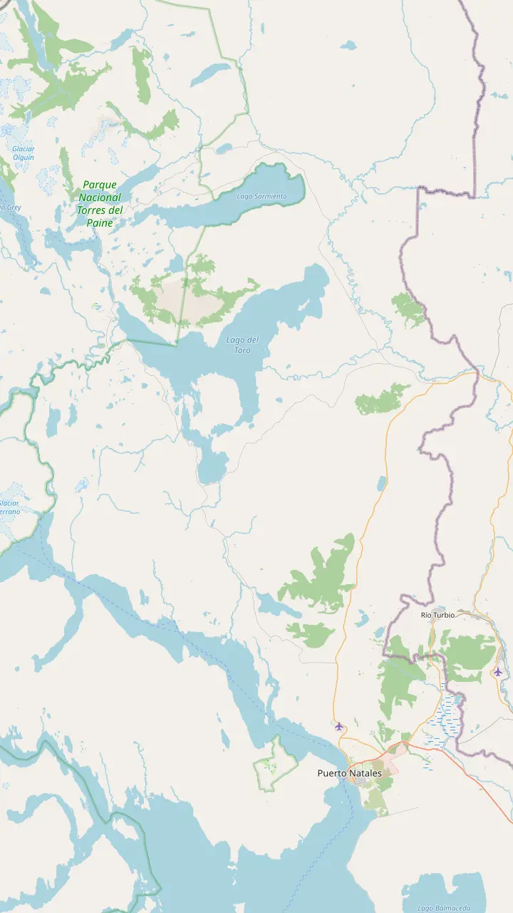
The harbor town where the guided day hike collects you between 6:15 and 6:45; park buses leave its terminal each morning and early afternoon, with times that differ between CONAF and Bus-Sur.
Google MapsThe park's eastern gate; Route 9 North via Cerro Castillo reaches the Sarmiento and Laguna Amarga gates in 115 to 145 km.
Google MapsThe park's main gate, where tickets are checked and the Las Torres shuttle leaves for the Welcome Center, 7 km and 25 minutes away.
Google MapsThe hikers' base at the entrance to Las Torres reserve, with free bathrooms and drinking water; the trail starts in the Hotel sector beside it.
Google Maps© OpenStreetMap contributors, map data
What is the Mirador Base Las Torres altitude, which tower is which, and why is the water that colour? A field guide to the end of the trail, from the park's own sources.
Editorial team, baseofthetowershike.com · Updated November 12, 2026 · Takes 8 min
Essentials
The Mirador Base Las Torres altitude depends a little on who measured it. Las Torres Patagonia, which manages the reserve at the trailhead, puts the highest point of the walk at 850 meters above sea level.1 A guided listing's description puts the viewpoint at 890 meters, and another describes an elevation gain of almost 900 meters for the day. Read the lookout as sitting a little under 900 meters, well above the hotel and the valley floor.1
That height is modest by mountain standards, and it is not what makes the place feel high. What you feel is the wall in front of you. Chile's tourism board describes the three granite needles as rising nearly 2,900 meters above the Patagonian steppe, and CONAF gives 3050 m above sea level as the highest point of the Paine massif as a whole.6,7 The lookout is a seat in the front row, not a summit.
The climb to that seat is what most people remember. CONAF calls the final 1.4 km above the ranger post demanding and cautions that the moraine is hard on leg joints.8,9 Arrive with something left in the legs, as the way back down over the same rocks is part of the day too. Pace the whole round trip, not just the way up: the descent is hard on the knees.
What you see from the lookout
| Feature | Where it is | What to know |
|---|---|---|
| Torre Sur | Left of the group | Named on the day hike's record |
| Torre Central | In the middle | Granite, like its neighbours2 |
| Torre Norte | Right of the group | Named on the day hike's record |
| Cerro Nido de Cóndor | North of the towers | Closes the cirque on the right |
| Lago Torres | Below the lookout | No swimming in the park5 |
| The moraine | Under your feet | Glacial debris, rated demanding9,8 |
Names from the guided day hike's record; rules and ratings from CONAF and the park's own site.8,5
From the lookout you face the towers across the lagoon, looking roughly west. The guided day hike's own record names what you see: Torre Sur, Torre Central and Torre Norte, with Cerro Nido de Cóndor alongside. On the towers panel of the map, Torre Sur is the southern peak on the left, Torre Central stands in the middle and Torre Norte rises on the right, with Cerro Nido de Cóndor beyond it to the north.
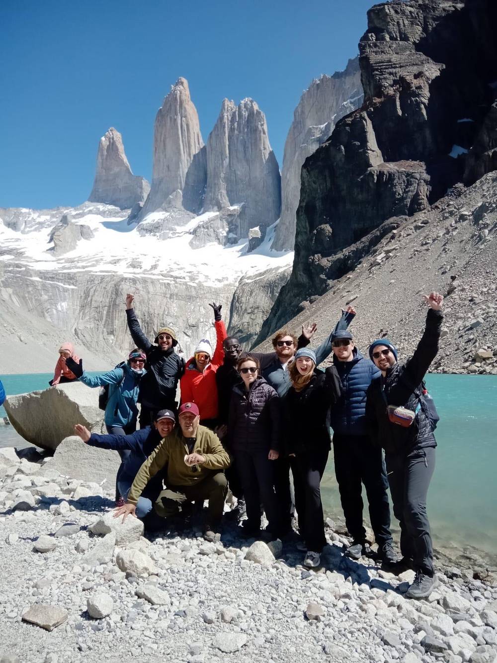
The towers are close enough together that they read as a single wall in flat light and as separate needles when the sun comes from the side. Look for the gaps between them, the snow and ice that clings to their ledges and the scree fans pouring down to the water. The sense of scale is hard to take in, and figures on the far shore of the lagoon help. A person standing by the water is a speck against the granite.
The name of the park comes from these peaks and their neighbours. CONAF says the park is known worldwide for the massifs that give it its name, which it calls granite giants shaped by the force of glacial ice.13 The towers are the most famous of those giants, and the Las Torres base viewpoint is the closest a hiker on the trail gets to them. Going higher is mountaineering, a different activity altogether, and not part of a hiking day.
The Paine range is not part of the main Andes chain. CONAF describes it as an independent mountain system, made of sedimentary rock in its highest part and granite at its base.2 The granite formed from magma that cooled slowly underground inside older layers of sediment. The hard, pale rock now sits under and beside darker, softer rock across the massif. The contrast between granite and the darker rock gives the Paine its banded look from a distance.
Ice did the rest. CONAF says the range's forms were shaped by the advance and retreat of glaciers more than 12 million years ago.3 Glaciers and frost stripped away much of the softer rock, while the granite, harder and more massive, stood its ground. The towers are what remained after that long carving, and the moraine you climb at the end of the trail is debris that ice left behind.
You can read some of that story from the lookout. The clean, steep faces show how granite breaks along long vertical joints, the boulder field under your feet shows where the ice dropped its load, and the lagoon fills the hollow that the glacier scooped out. It is geology you can see without a textbook, as long as you take a minute to look for it. Ask your guide to point out the features; it turns a view into a story.
At the top
Weather and the clock set how long you stay.
If I want the classic photo
Wait for a gap in the cloud
Light shifts fast over the towers; staying a while beats a quick frame.
If I want to get closer to the water
Stay on the worn path
CONAF asks visitors not to leave the trails or climb rocks.14
If I am getting cold quickly
Layer up and start down
The trail closes from the lookout by 16:00 even in midsummer.15
If I want to know which tower is which
Left to right: Sur, Central, Norte
The day hike's record names Torre Sur, Torre Central and Torre Norte.
If I want a guide to explain the geology
Book the guided day hike
A live guide in English and Spanish, with pickup from Puerto Natales.
Meet the towers
Left
The southern tower
Book the day hike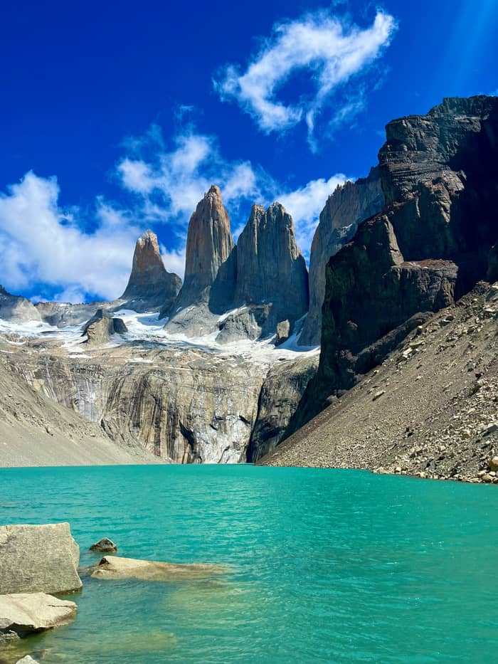
Centre
The middle tower
Book the day hike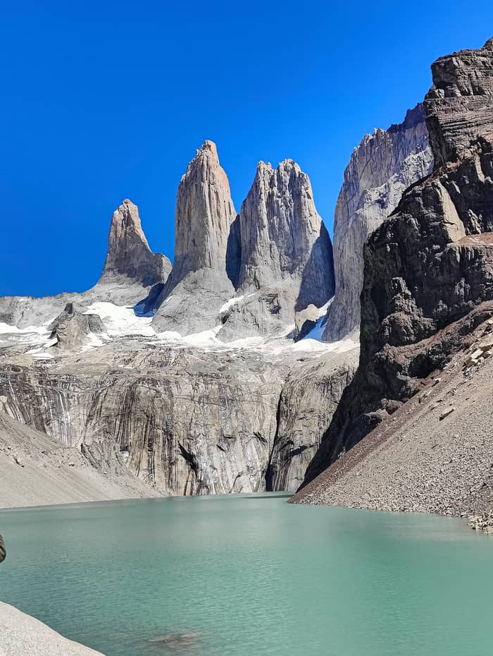
Right
The northern tower
Sernatur pictures the trail's end as a turquoise pool lying under the massif.4 The water sits in the basin between the lookout and the cliffs, fed by snow and ice from the towers above. On maps it carries the name Lago Torres, and it is the colour, more than the size, that stops people at the rim. The first sight of it, after the last boulders of the moraine, is the moment the climb pays off.
That colour comes from fine rock flour. Glaciers grind the rock beneath them into silt so fine that it stays suspended in meltwater, and the particles scatter blue and green light back to your eye. Under a bright sky the water looks milky turquoise; under cloud it turns a deeper green-grey, which is worth knowing before you judge the view on a dull day. Even in grey weather the water keeps some of its colour, and it can lift a dull photograph.
Enjoy it from the shore. The park prohibits swimming in all its lakes, lagoons and rivers because of the high risk of drowning, and the water here is glacier-cold.5 CONAF also asks visitors to stay on the trails and not to climb rocks, so keep to the worn path and the obvious viewing area rather than scrambling down toward the water.14 The loose boulders around the shore move underfoot, and a twisted ankle here is a long way from help.
Reach the lookout with a guide
Select a guided Base Torres trek and the size of your party.
Compare 3 side by side
Select a guided Base Torres trek and the size of your party.
≈
View≈
View≈
ViewGetYourGuide's starting prices, converted at the ECB reference rate; exact pricing appears when you book.
The story of the place
Deep time
Glaciers shaped the range more than 12 million years ago.3
The park
Created by decree DS 383 on 13 May 1959.10
UNESCO
Declared a Biosphere Reserve in 1978.11
Today
Hikers without a guide allowed up again from 16 September 2026.12
How long you stay depends on the clock and the weather. Guided days build in a set stop: a listing gives a 40-minute break and photo stop at the Mirador Base Las Torres, and another a 45-minute break and photo stop. That is a sensible length for lunch, photographs and a rest before the descent. Sit out of the wind behind a boulder if you can find one, and keep your pack on a flat rock so nothing rolls away.
Independent hikers have a hard limit too. The park's bulletin closes the trail from the lookout at 16:00 from December to February, at 15:00 in October, November, March and April, and at 14:00 in September and winter.15,36,37,38,39 Work backwards from that time when you decide how long to sit by the water. Independent hikers who started late should treat the closing time as the moment to leave, not to arrive.
The lookout is exposed. With no shelter and wind coming off the ice, it cools you quickly once you stop walking, even on a sunny day. Put on a warm layer as soon as you arrive, eat something and keep an eye on the sky behind the towers, where weather often appears first. If it closes in, take your photographs and start down. The towers will look just as good from the forest below if the cloud lifts later in the day.
Video
Where I've Been Wandering on YouTube · The video only starts loading on your tap.
It is known worldwide for the massifs that give it its name, granite giants shaped by the force of glacial ice.
Lookout checklist
Good Mirador Base Las Torres photos come from patience more than gear. Light changes fast as clouds pass over the towers, so stay a while and shoot when a gap opens, rather than taking a single frame on arrival. Shooting from slightly above the water gives you both the lagoon and the full height of the towers. A wide-angle lens, or a phone's widest setting, takes in the whole cirque at once.
Keep the rules in mind. CONAF keeps the park free of drones apart from approved scientific or professional film work, and the park allows photography of wildlife only in daylight and from the official trails.33,40 CONAF also prohibits feeding or disturbing the native wildlife, which matters at a spot where everyone stops to eat.34 Pack every crumb and wrapper back into your bag before you leave.
Protect your phone and your hands. Wind at the lookout can knock a phone out of cold fingers, and the rocks are unforgiving. A wrist strap, thin gloves and a spare battery kept warm in an inside pocket make the difference. The park says there is no phone signal on its interior trails, so share your pictures when you are back at the trailhead.41 Download any trail map you want to use before you leave Puerto Natales.
The towers are the emblem of a large protected area. The protected area covers 227,298 hectares, CONAF says, and dates from a decree signed on 13 May 1959.42,10 UNESCO added it to its network of Biosphere Reserves in 1978, under the Man and the Biosphere programme.11 The view from the lookout is part of a landscape protected for decades, and the rules on this page exist to keep it that way.
The trail to the towers also crosses some of the park's living landscape. On the climb, Sernatur notes, Mount Almirante Nieto stays in view and condors circle overhead; CONAF's list of animals visitors see easily adds guanacos, foxes, rheas and swans.27,43 Keep an eye on the sky above the lookout: condors ride the same winds that make the place so cold. Watching them overhead is part of the reward for the climb.
If the lookout leaves you wanting more, the guided day hike from Puerto Natales gets you there without worrying about buses, the shuttle or the latest start. Prices start from $99 with pickup in Natales and an English- or Spanish-speaking guide. Use the towers panel on the map to see the lookout, the lagoon and the granite, and how they sit at the head of the valley you climb. Switch between the panels to see how close the lookout really is to the granite.
FAQ
Las Torres gives 850 meters as the route's high point; a tour listing puts the viewpoint at 890 meters.1
The day hike's record also names Cerro Nido de Cóndor beside them.
Sernatur places the turquoise water at the foot of the massif, where the climb ends.4
Swimming is banned in every lake, lagoon and river of the park, given the high risk of drowning.5
Guided listings give a 40-minute and a 45-minute break and photo stop at the lookout.
Only authorised research or professional film crews may fly them, says CONAF.33
Sources
Related guides
Planning the Base Torres day? Ask a real person.